News
【Japan Winter Weather Forecast for 2026-2027】Cold Waves and Heavy Snow Still Possible Even in a Mild Winter
2026.10.21
According to the forecast by the Japan Weather Association (JWA), temperatures across Japan are expected to be higher than normal in November 2026, delaying the arrival of winter. From December 2026 through February 2027, temperatures are also expected to be higher than normal on average across Japan, resulting in a mild winter overall.
However, even during a mild winter, strong cold air may temporarily move into Japan, causing temperatures to drop sharply.
In addition, while typical winter pressure patterns are less likely to persist, low-pressure systems are more likely to pass along the southern coast of Japan. As a result, attention should be paid to snowfall and heavy snow even on the Pacific side of Japan, where snow is normally less common.
This article explains the weather outlook from November 2026 through February 2027 and its potential impacts on business activities.
*Please refrain from unauthorized corporate use of this information, including quotations in press releases or use for promotional purposes. If you are considering corporate use of this information, such as for product promotion or providing information to customers, please contact us.
Key Points of This Article
- Temperatures are expected to be higher than normal across Japan in November 2026.
- This winter (December 2026-February 2027) is expected to be mild on average across Japan.
- Snowfall on the Sea of Japan side is expected to be below normal, but temporary cold waves and localized heavy snow will still require attention.
- Low-pressure systems along the southern coast of Japan may bring snow even to the Pacific side, where snowfall is normally less common.
- Business decisions should take into account not only monthly average temperatures but also year-on-year differences and short-term temperature fluctuations.
Table of Contents
- Winter Weather Forecast for 2026-2027 | Warm November, Followed by a Mild Winter from December through February
- Can Cold Waves and Heavy Snow Still Occur During a Mild Winter? Points to Keep in Mind When Using Winter Forecasts
- Why the Winter of 2026-2027 Is Expected to Be Mild
- How Winter Weather in 2026-2027 May Affect Business Activities
- Key Points for Using Weather Forecasts in Winter Business Planning
- Summary | Prepare for Cold Waves and Heavy Snow While Planning for a Mild Winter
- FAQ on the Winter Weather Forecast for 2026-2027
- Professional Profile
Winter Weather Forecast for 2026-2027 | Warm November, Followed by a Mild Winter from December through February
The figure below summarizes the key points of the forecast for winter 2026-2027, covering December through February.
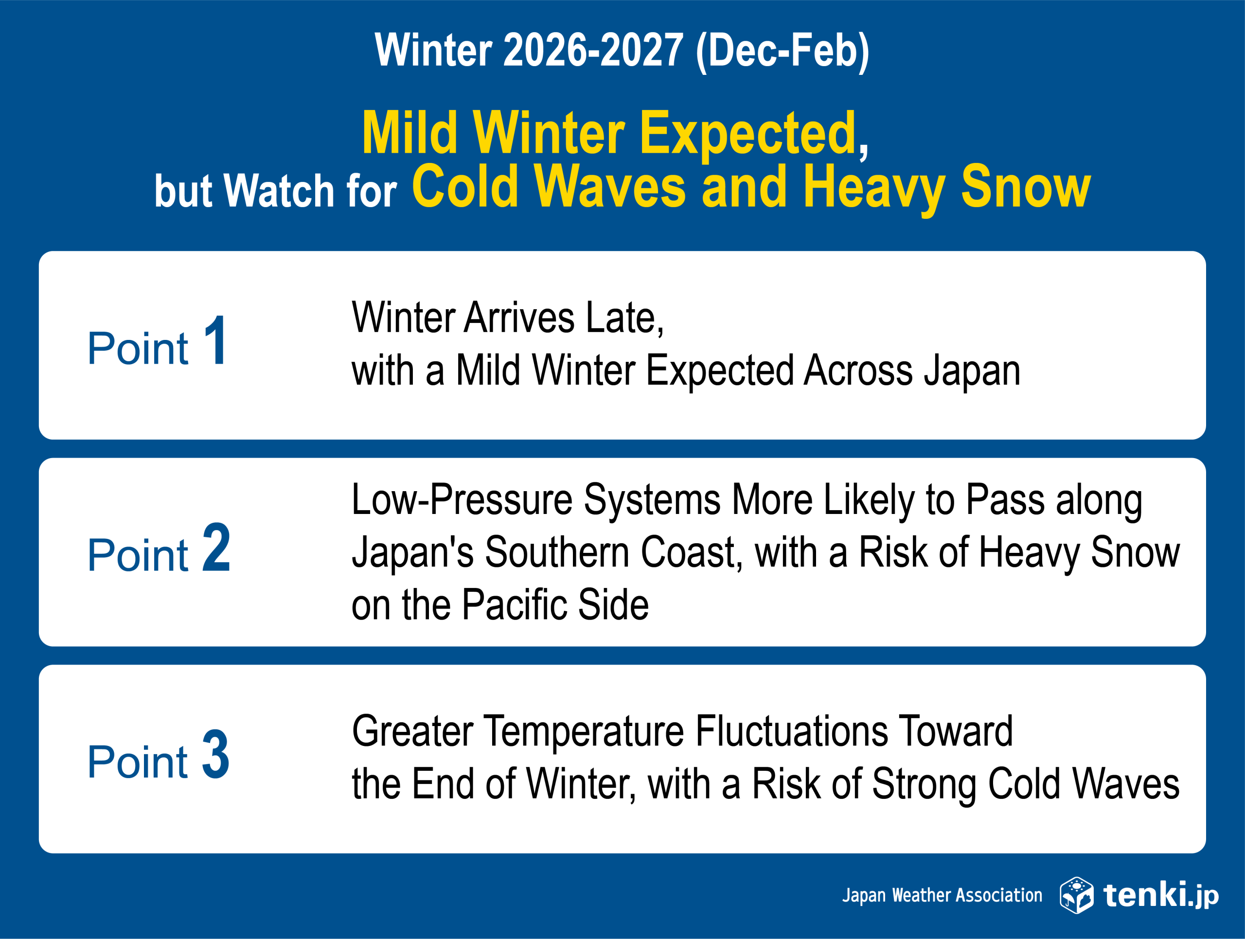
The weather outlook from November 2026 through February 2027 is as follows.
| Period | Temperature and Weather Outlook | Points to Note |
|---|---|---|
| November 2026 | Temperatures are expected to be higher than normal across Japan | A stationary front may bring extended periods of cloudy or rainy weather, and temperatures may drop over a short period. |
| December 2026-January 2027 | Temperatures are expected to be higher than normal on average across Japan, resulting in generally mild winter conditions. | Snow on the Pacific side caused by low-pressure systems along the southern coast of Japan, as well as temporary cold waves |
| February 2027 | Average temperatures are expected to be higher than normal, but with large temperature fluctuations | Sudden cold spells and localized heavy snow mainly on the Sea of Japan side |
| Winter overall |
|
Heavy snow may occur over short periods despite the overall seasonal tendency |
Autumn Warmth Expected to Continue into November
Temperatures are expected to be higher than normal across Japan in November.
Cold, dry seasonal winds are less likely to blow, and fronts or low-pressure systems may bring periods of cloudy or rainy weather. Temperatures may also fall over short periods.
Mild Winter Conditions Expected from December through January, but Snow on the Pacific Side Requires Attention
From December through January, temperatures are expected to be higher than normal on average across Japan, and the arrival of full-fledged winter is expected to be delayed.
Typical winter pressure patterns are less likely to persist, so snowfall on the Sea of Japan side is expected to be below normal. On the other hand, low-pressure systems are more likely to pass along the southern coast, so attention should be paid to snowfall even on the Pacific side, where snow is normally less common.
In addition, after a low-pressure system passes along the southern coast, strong cold air may temporarily move southward, potentially resulting in localized heavy snow on the Sea of Japan side.
Spring May Arrive Early in February, but Temperature Fluctuations Will Be Large
Average temperatures are also expected to be higher than normal in February, making an early arrival of spring more likely. However, temperature fluctuations tend to become greater toward the end of winter, and a strong cold air mass may move southward over Japan.
Below-Normal Snowfall Expected on the Sea of Japan Side, with Above-Normal Precipitation on the Pacific Side
During the winter of 2026-2027, snowfall on the Sea of Japan side is expected to be below normal because Typical winter pressure patterns are less likely to persist.
Meanwhile, low-pressure systems are more likely to pass along the southern coast, and precipitation is expected to be above normal, particularly on the Pacific side. Depending on the temperature and track of these low-pressure systems, heavy snow may occur even in areas where snow is normally less common.
Can Cold Waves and Heavy Snow Still Occur During a Mild Winter? Points to Keep in Mind When Using Winter Forecasts
A “mild winter” means that the average temperature over the three winter months is higher than normal. It does not mean that warm conditions will persist throughout the entire winter.
Although the winter of 2026-2027 is expected to be mild on average, strong cold air may move into Japan after low-pressure systems pass along the southern coast, causing temperatures to drop sharply over a short period. On the Sea of Japan side, even if total snowfall over the winter is low, localized heavy snow may occur when cold air intensifies.
On the Pacific side, if temperatures in the upper atmosphere and near the surface are low when a low-pressure system passes along the southern coast, precipitation may fall as snow rather than rain. It is therefore important to check the latest forecasts concerning cold air and low-pressure systems, rather than relying only on average winter temperatures and snowfall amounts.
Why the Winter of 2026-2027 Is Expected to Be Mild
Weather conditions in Japan are affected by interactions between the ocean and atmosphere, including variations in sea surface temperatures in the tropical Pacific and the Indian Ocean.
Effects of El Niño
An El Niño event is currently believed to be occurring in the tropical Pacific, with higher sea surface temperatures in the eastern part of the region and lower temperatures in the western part. These conditions are expected to continue into winter.
El Niño is a phenomenon in which sea surface temperatures become higher than normal in the equatorial Pacific from around the International Date Line to the coast of South America, and this condition persists for approximately one year. Winters in which El Niño occurs tend to be mild in Japan.
From December through February, the effects of El Niño on atmospheric circulation are expected to make temperatures across Japan more likely to be higher than normal, resulting in a generally mild winter. Low-pressure systems are also expected to be more likely to pass along the southern coast of Japan, potentially bringing rain or snow mainly to the Pacific side.
Effects of the Positive Indian Ocean Dipole and Other Factors
A positive Indian Ocean Dipole event, characterized by higher sea surface temperatures in the western Indian Ocean, is expected to develop through autumn 2026.
A positive Indian Ocean Dipole is a phenomenon in which sea surface temperatures are higher than normal in the western Indian Ocean and lower than normal in the eastern Indian Ocean. Through its effects on atmospheric circulation, it can influence the westerly winds around Japan and the progression of the seasons.
From October through November, the effects of the positive Indian Ocean Dipole and other factors are expected to make Japan more likely to be covered by warm air and less likely to experience southward movement of cold air.
However, winter weather in Japan is not determined by any single phenomenon. Long-range forecasts indicate general weather tendencies over an extended period, while outlooks for notable high or low temperatures, prolonged rainfall, and other conditions over periods of several weeks may change depending on future atmospheric conditions. When using long-range forecasts, please also check the latest information, including one-month forecasts.
How Winter Weather in 2026-2027 May Affect Business Activities
Under mild winter conditions, demand for winter-related products and heating may be lower than normal over the season as a whole.
On the other hand, temporary cold waves or snowfall may have significant short-term impacts on demand and transportation.
Manufacturing and Retail | Responding to Delayed Demand for Winter Products and Sudden Changes in Demand
If higher-than-normal temperatures continue in November, demand for winter-related products may be delayed. However, if temperatures fall sharply during a short-term cold wave, demand for cold-weather goods and hot food and beverages may increase suddenly.
Apparel | Adjusting the Timing of Winter Product Launches and Inventory Allocation to Temperature Changes
Due to higher-than-normal temperatures in November, full-scale demand for winter clothing such as coats and heavy knitwear is expected to be delayed.
In addition, because temperature fluctuations are likely to become greater in the latter half of winter, winter inventory management and the transition to spring products will need to take short-term temperature changes into account.
For more information, see “Autumn/Winter 2026 Forecast | How Will Apparel Demand Change?”
Logistics | Preparing for Transportation Disruptions Caused by Low-Pressure Systems along the Southern Coast and Cold Waves
On the Pacific side, rain and snow caused by low-pressure systems passing along the southern coast may affect road, rail, and air transportation. In areas where snow is normally uncommon, even brief snow accumulation may cause major transportation disruptions.
Energy | Monitoring Fluctuations in Heating Demand and Changes in Power Generation
Under mild winter conditions, heating demand may be lower than usual over the season as a whole. On the other hand, heating demand may rise sharply over a short period during a cold wave, meaning that monthly average temperatures alone are not sufficient to capture fluctuations in supply and demand.
In addition, because precipitation is expected to be above normal, particularly on the Pacific side, changes in solar radiation may cause fluctuations in solar power generation output. Supply and demand outlooks should therefore be updated regularly using combined forecasts for temperature, precipitation, and solar radiation.
Key Points for Using Weather Forecasts in Winter Business Planning
Long-range forecasts provide useful information when considering plans for production, inventory, promotion, logistics, energy supply and demand, and other operations, based on seasonal and monthly trends in temperature and precipitation.
Check Differences from Normal, the Previous Year, and the Recent 10-Year Average
When companies develop plans for sales, production, inventory, energy supply and demand, and other areas based on the previous year’s results, it is important to consider not only differences from normal but also differences from the previous year and from the recent 10-year average.
For example, although temperatures in February 2027 are expected to be higher than normal, they are expected to be lower than in February 2026. In this case, even with a mild winter forecast, demand for heating and winter-related products could be higher than in the previous year.
Update Plans from Long-Range Forecasts to Short-Range Forecasts
For businesses, it is important to first establish the overall direction based on long-range forecasts and then update plans using one-month forecasts, two-week temperature forecasts, and short-range forecasts as the implementation period approaches.
| Weather Information | Main Uses |
|---|---|
| Long-range forecast | Determine overall winter policies for demand, production, procurement, and inventory |
| One-month forecast | Review monthly production volumes, order quantities, and inventory allocation |
| Two-week temperature forecast | Adjust product deployment by region, promotional activities, and transportation plans |
| Short-range forecast | Make decisions on additional orders, changes to store displays, transportation and delivery, and facility operations |
For more information on how to use forecasts with different forecast periods, see What are Long-Term Forecasts? JWA’s Proprietary “2-Year Long-Term Weather Forecast” and Its Business Applications Part 1 / Part 2
For Businesses Looking to Use Long-Range Forecasts in Business Planning
JWA provides its 2-Year Long-Term Weather Forecast service, which predicts weather trends up to two years in advance to support corporate activities requiring long planning lead times, including manufacturing, procurement, inventory management, marketing, and energy supply and demand planning.
In addition to seasonal and monthly weather trends, the service provides comparison data that can be readily used in business planning, including differences from normal, differences from the previous year, and differences from the recent 10-year average. JWA also supports companies in using weather changes in decision-making according to their specific business challenges and target products.
If you would like information on weather trends from summer 2027 through 2028 that is not covered in our publicly available articles, more detailed monthly and regional forecasts, or analysis combining weather forecasts with your business data, please see the 2-Year Long-Term Weather Forecasts.
- Learn more about the 2-Year Long-Term Weather Forecasts
- Contact Us
Summary | Prepare for Cold Waves and Heavy Snow While Planning for a Mild Winter
Temperatures are expected to be high across Japan in November 2026, which may delay the rise in demand for winter-related products.
This winter (December 2026-February 2027) is also expected to be mild on average across Japan.
However, temporary cold waves and localized heavy snow may still occur even during a mild winter.
Due to the effects of low-pressure systems along the southern coast, caution will also be required on the Pacific side, where snow is normally less common.
FAQ on the Winter Weather Forecast for 2026-2027
Q. Will the winter of 2026-2027 be mild?
A. From December 2026 through February 2027, temperatures are expected to be higher than normal on average across Japan, resulting in a mild winter overall. However, this does not mean that conditions will remain warm throughout the winter, and strong cold air may temporarily move into Japan.
Q. When will it start getting cold in 2026?
A. Temperatures are expected to be high across Japan in November, and the arrival of full-fledged winter is expected to be delayed. Current long-range forecasts cannot predict the specific dates on which it will become cold, so please check the latest information in one-month forecasts and two-week temperature forecasts.
Q. Can cold waves and heavy snow occur even during a mild winter?
A. Cold waves and heavy snow can occur even during a mild winter. A mild winter refers to a tendency in the average temperature over the three winter months and does not mean that short periods of strong cold air or localized heavy snow will not occur.
Q. Will there be a lot of snow during the winter of 2026-2027?
A. Total snowfall on the Sea of Japan side is expected to be below normal over the winter as a whole. However, if strong cold air moves into Japan after a low-pressure system passes, localized heavy snow may occur on the Sea of Japan side.
Q. Will it snow on the Pacific side as well?
A. If cold air moves into Japan when a low-pressure system passes along the southern coast, snow may fall even on the Pacific side, where snow is normally less common. Whether precipitation falls as rain or snow depends on the track of the low-pressure system and temperatures, so it will be necessary to check the latest forecasts as the relevant period approaches.
Q. Does an El Niño event always result in a mild winter?
A. It does not necessarily result in a mild winter. Winters in which El Niño occurs statistically tend to be mild in Japan, but actual weather conditions are influenced by multiple factors, including sea surface temperatures and atmospheric circulation.
Q. How can companies use winter long-range forecasts?
A. Companies can use forecasts of overall winter temperature and precipitation trends to support production, procurement, inventory, promotional, logistics, and energy supply and demand planning. It is important to establish the overall direction using long-range forecasts and then progressively update plans using one-month forecasts, two-week temperature forecasts, and short-range forecasts as the implementation period approaches.
Professional Profile

Kumi Okoshi
With the advice and cooperation of Professor Hiroaki Ueda of the University of Tsukuba, she worked on developing new seasonal forecasting technologies and developed the weather industry’s first forecasting methodology capable of predicting weather conditions up to two years in advance (Patent No. 7569539).
She provides weather consulting services using the 2-Year Long-Term Weather Forecast for companies in the food, household goods, apparel, and energy industries.
She received the FY2025 Awards for Science and Technology (Science and Technology Promotion Category) under The Commendation for Science and Technology by the Minister of Education, Culture, Sports, Science and Technology for “Promotion of Social Implementation Based on the Development of Fundamental Technologies for Seasonal Forecasting.”